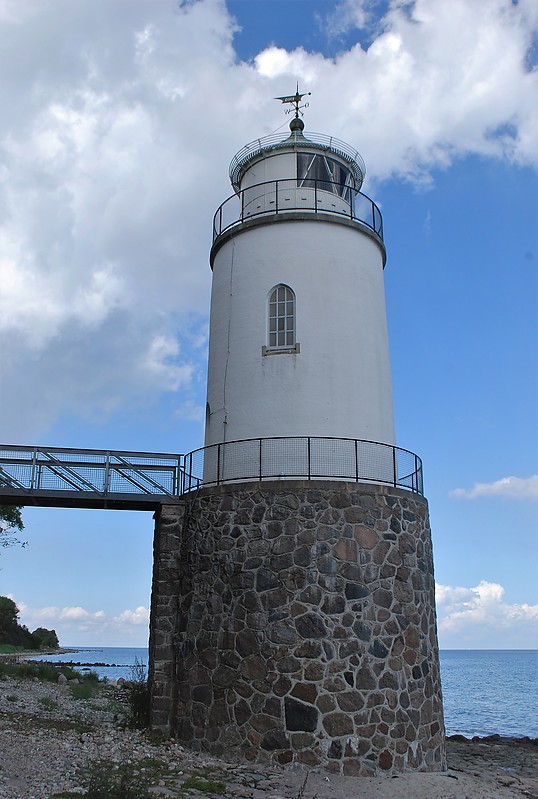
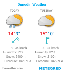
| File information | |||
| Album name: | mitko / Denmark | ||
| Current status (active, not active, museum etc): | Active | ||
| Height of the tower, m: | 19 | Focal plane elevation above sea level, m: | 15 |
| Light Description (light sectors, colour of the light, number of flashes etc): | Group occulting, 2 flashes per 12s, 127-135 green, 135-139 white, 139-174 red, 174-186 green, 186-323 white, 323-127 no light | ||
| Range, nm: | white 15 nm, green 12 nm, red 12 nm | ||
| Coordinates (in any format): | 55 0.4046 N 9 57.8355 E | ||
| Displayed: | 14 times | ||
| Date added: | Aug 23, 2020 | ||
| DateTime Original: | 2020:08:19 14:40:05 | ||
| Keywords: | Denmark ; Little Belt ; Jylland | ||
| BBCode: | |||
| Download Link: | Open picture in new window | ||


No comments:
Post a Comment
How did you like the post, leave a comment. I would appreciate hearing from you all. Best wishes from JC's Naval, Maritime and Military News