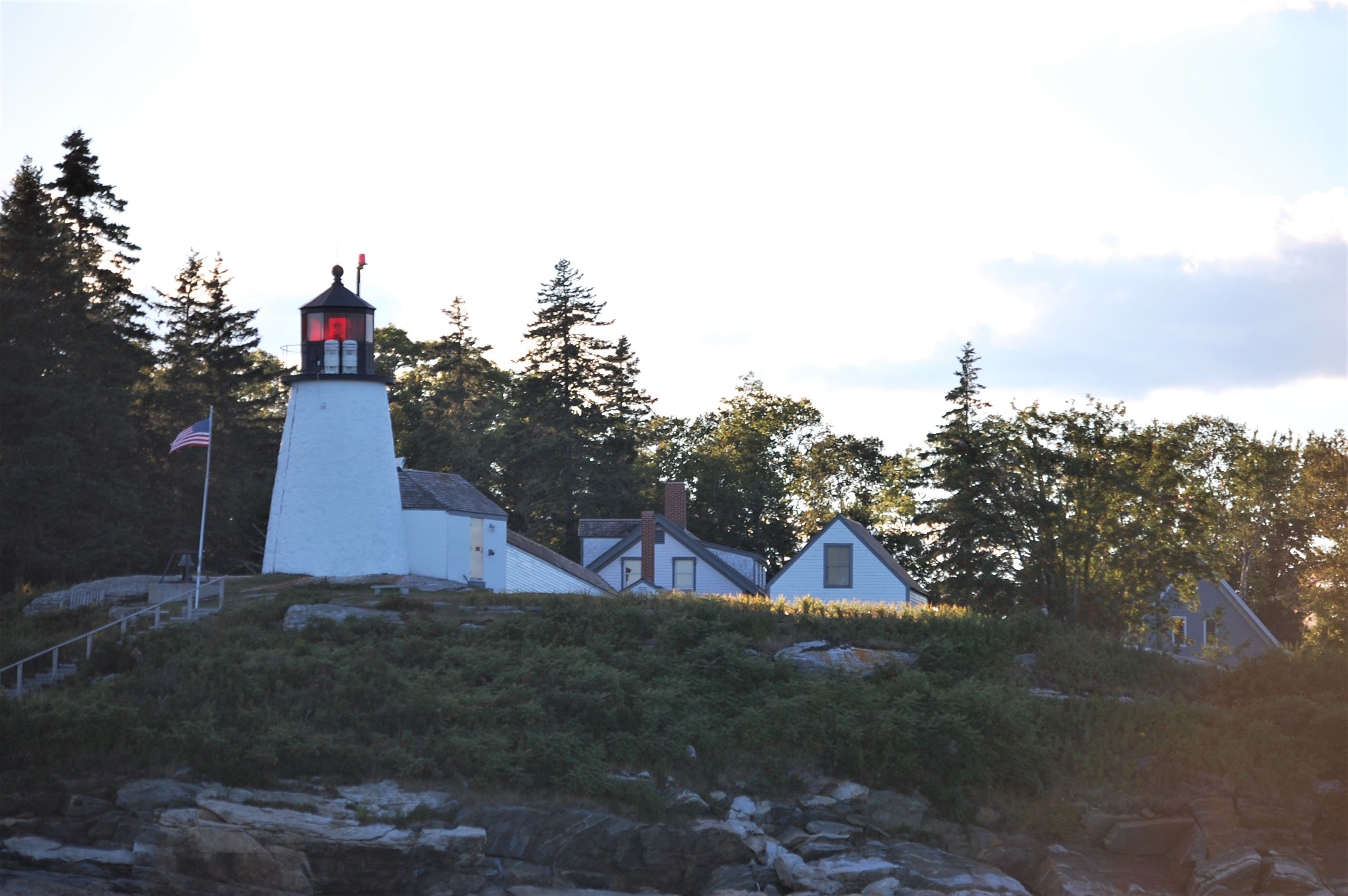
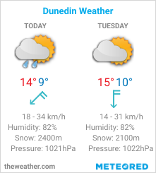
| File information | |||
| Album name: | mitko / Northeast coast of US | ||
| Current status (active, not active, museum etc): | Active | ||
| Construction details (year of built, shape etc): | 1821 | ||
| Focal plane elevation above sea level, m: | 18 | ||
| Light Description (light sectors, colour of the light, number of flashes etc): | Flashing, 6s, flash 0.6s, eclipse 5.4s, 307-316 white, 316-355 red, 355-8 white, 8-307 red | ||
| Range, nm: | white 8 nm, red 6 nm | ||
| Any other comments: | Covers fairways. Emergency light. Horn(1)10.00s. | ||
| Coordinates (in any format): | 43.825053,-69.640175 | ||
| Displayed: | 5 times | ||
| Date added: | Aug 13, 2020 | ||
| DateTime Original: | 2007:09:01 18:16:04 | ||
| Keywords: | Maine ; United States ; Atlantic ocean | ||
| BBCode: | |||
| Download Link: | Open picture in new window | ||


No comments:
Post a Comment
How did you like the post, leave a comment. I would appreciate hearing from you all. Best wishes from JC's Naval, Maritime and Military News